Disclosure: This post may contain affiliate links. I earn a small commission of product sales to keep this website going.
Some of the most commonly misunderstood practice questions for the FAA Remote Pilot test involve towers in controlled airspace – particularly this example of a tower near Coeur d’Alene-Boyington Airport. It’s a question that trips up a lot of students, and unfortunately, a lot of instructors, too. Let’s work through it.

The Question
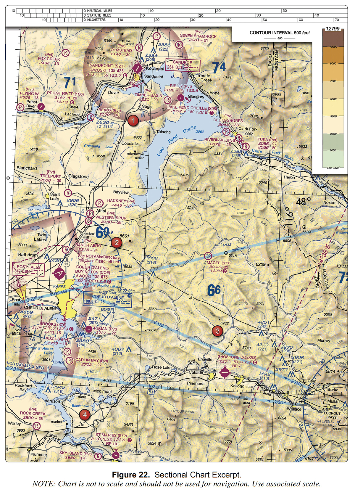
While inspecting the obstacle located 3 miles northwest of Coeur d’Alene-Boyington Airport, what is the highest altitude above ground level that you can fly?
A) 2,429 feet AGL, the height of the obstacle
B) 400 feet above the ground
C) 400 feet above the top of the obstacle, if you stay within 400 feet horizontally
The correct answer is C – but other instructors incorrectly said it’s B. Understanding why it’s really C requires understanding one of the most important test-taking principles for the Remote Pilot test: only use the information the question gives you.
The Most Important Rule
When you encounter a tricky exam question, resist the urge to bring in outside information. Don’t assume what authorization was received. Don’t assume the current airspace status. Don’t assume anything the question doesn’t explicitly state.
This sounds obvious, but it catches students all the time.
What the Question Actually Tells Us
Look at what information we actually have: a location (3 miles northwest of Coeur d’Alene-Boyington Airport) and an obstacle with a known MSL height. That’s it.
Now watch what happens when we start making assumptions about things the question doesn’t tell us:
- No authorization obtained: we can’t legally fly at all. None of the answers are correct.
- LAANC authorization to 400′ AGL: answer B (up to 400′ AGL) looks correct. But that’s an assumption the question never stated.
- LAANC automatic ceiling of 100-200′ AGL (which is actually the case for this specific location): none of the answers are correct.
- Manual DroneZone structure inspection authorization: allows flight up to 100′ above the structure, but that’s not even an answer choice, and the ceiling depends on the tower AGL height, which we don’t know in this question.
- Airspace reverts to Class G per NOTAMs: uncontrolled airspace, no authorization needed, answer is C.
- No assumptions, pure 107.51: answer is C.
Five different assumptions. Five different answers. Only one approach requires no assumptions at all.
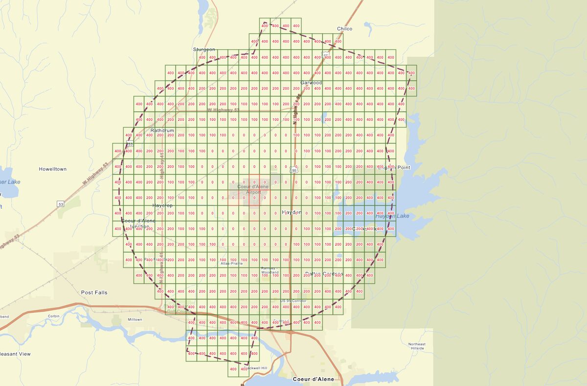
Bringing LAANC and DroneZone complexities into this question, which only asks “how high can you fly above a tower,” we see the tower in question is actually near 100′-200′ sectors. Answer B is obviously no longer the “most correct answer”:
What the FAA Says
Part 107 Regulations
14 CFR 107.51 establishes the altitude limits for remote pilot operations. The relevant provision: you may not fly more than 400 feet above the highest point of a structure, provided you remain within 400 feet of it horizontally.
That’s answer C. No authorization status required. No airspace assumptions needed. Just the regulation, applied to the information provided (your tower).
You will need authorization to fly this mission in real life, and you’ll need to follow the restrictions in that specific authorization. But we’re never given any restrictions for this question.
The FAA’s Facility Operation & Administration Document
This isn’t just one instructor’s interpretation. The FAA’s own documents back it up.
The document that defines how UAS Facility Maps are built – the very system often cited as proof that 400′ AGL is an absolute ceiling – contains this note in its assumptions section:
“Part 107 allows operators to fly 400 feet AGL, and if within a 400-foot radius of a structure or obstacle, they can fly to the height of the structure plus 400 feet.”
The document then explains that maps are only evaluated to 400 feet AGL, not because 400 feet is the absolute ceiling, but because the map wasn’t designed to evaluate above that altitude. That’s a design limitation, not a regulatory ceiling. The FAA says so explicitly in the document that governs the map.
In the “Regulatory and Procedural Information” chapter of this document, you can read a DroneZone manual authorization specifically for structure inspections that allows flight up to 100 feet above the structure without any further ATC coordination. This directly contradicts the argument that 400′ AGL is an absolute ceiling in controlled airspace.
So, there is nothing stated anywhere that 14 CFR 107.51(b) does not apply in controlled airspace – on the contrary, those documents say it does. That doesn’t mean you have blanket authorization to fly 400′ above structures in controlled airspace. It just means that’s the default starting point, and other restrictions will be added on top of that, depending on several other factors.
The “Default” Argument
Some instructors argue that since the airspace defaults to Class E2 and the UAS Facility Map “ceiling” is 400′, the answer should be B – you can only fly up to that ceiling. But the default automated LAANC ceiling for this specific location isn’t 400′ – it’s 100 to 200 feet, which you’ll never know while taking the test. If you want to fly higher, you have to request manual authorization, but that altitude limit will depend on a variety of factors. 400 feet isn’t guaranteed.
So even by the “default” logic, the default isn’t 400′ AGL. 400 feet AGL is only accurate when a) the LAANC limit for that sector is 400′, or b) you’ve received manual authorization to 400′.
And more importantly, the question doesn’t ask about the default altitude. It asks what the highest altitude you can fly is. Those are two different questions. And according to 107.51, the highest you can fly, generally, is 400′ above a structure, within a 400′ radius.
Why This Matters Beyond the Test
I’ve never been an advocate of “teaching to the test” (memorizing answers). That approach produces pilots who can pass an exam but don’t understand why the rules exist, and that’s dangerous. But there’s a difference between teaching to the test and teaching students to answer a test question correctly using only the information provided.
A student who learns to import assumptions onto a test question will import those same assumptions in the field. Teaching students to work only with the information they actually have isn’t just a good test-taking strategy; it’s also good airmanship. Assumptions have gotten many pilots killed.
The Remote Pilot test is already challenging enough with everything you need to learn. Introducing operational procedures and extra-regulatory complexity that aren’t on the test doesn’t make you a better pilot, it just makes the test harder and more confusing.
The Bottom Line
In this question, the only information we have is the location and height of the obstacle. The question asks how high we can fly above an obstacle. 107.51 tells us we can fly 400 feet above it within a 400-foot radius. That’s answer C.
Everything else is an assumption.
When flying this in real life, you’ll have other airspace authorization restrictions, but you won’t know what those are until you get there. For the test, it simply wants to know how high you can fly above an obstacle.
If you want to study for your Remote Pilot test without wading through information you don’t need, my Part 107 course covers exactly what’s on the test. Nothing more, nothing less. Same pass rate and average score as the biggest names in the industry, in half the time. Enroll here and use code “blog20” for 20% off.
References: