
Backpacking the Lost Coast Trail - Everything you Need to Know
Disclosure: This post may contain affiliate links. I earn a small commission of product sales to keep this website going.
The Lost Coast Trail is one of my favorite thru-hikes and one of the best on the California coast. Quintessential Northern California coastal experience - tall cliffs, giant redwoods, moody fog, and abundant wildlife.
Important Update: Due to increasing crowd sizes, BLM has mandated permit quotas for overnight camping. More info below.
Revised 6/2/2019
Lost Coast Trail Description
The Lost Coast Trail is divided into two sections.
The northern section starts at Mattole Beach and is 24.6 miles on mostly level terrain, following the beach and meadows. It goes through the King Range National Conservation Area and ends at Black Sands Beach, Shelter Cove. This whole section is very sandy and makes hiking a little more difficult.
The southern section starts at Hidden Valley (near Shelter Cove). You can exit at either 9 miles at Needle Rock, or you can continue another 8 miles to Wheeler Camp and go back to Needle Rock. You can also continue 12 miles past Wheeler Camp to Usal Beach and shuttle back for a total of 29 miles. This section through the Sinkyone Wilderness is more strenuous with steeper terrain, going atop bluffs and through old-growth forests.


Lost Coast Trail Shuttle
You're going to have to either set up a personal shuttle or use one of the commercial Lost Coast shuttle operators to thru-hike either or both sections.
If you can afford the ~$85/person for a commercial shuttle, I'd recommend it since it makes things that much more convenient - less driving for you.
It takes about two hours to drive from Black Sands Beach, Shelter Cove, to the Mattole Beach trailhead (start).
Hiking north to south is the preferred direction due to prevailing winds, and everyone likes a cold beer after a hike and Shelter Cove has plenty of that. The shuttles are arranged to take you from Shelter Cove to Mattole Beach, and your car will be waiting for you when you're done.


The road is narrow and winding and it makes some people nauseous - the drivers usually carry ginger gum in the van for those people.
If you leave a car at the south end of the trail at Usal Beach, be aware that the six-mile road into this beach is very narrow, rutted, and gets very slick in rainstorms. Driving is sketchy even in 4WD vehicles during storms. Low-clearance, 2WD vehicles are not recommended. You can find this road at PCH mile marker 90.9, about 15 miles west of Leggett.
Thanks to David for notifying me that Sherri's Lost Coast shuttle service is no longer available. I've since used Lost Coast Adventure Tours and they're great!
Lost Coast Trail shuttle service:
-Mendo Insider Tours, 707-962-4131, mendoinsidertours.com/tours/private/. Email.
-Lost Coast Adventure Tours, 707-986-9895 or 707-502-7514, www.lostcoastadventures.com.
Food & Bears on the Lost Coast Trail

Food
There's a decent general store in Shelter Cove, and they'll most likely have any last-minute food & sundries you may need (but they're not a gear outfitter!).
So you really only need enough food for 3-4 days even if you're doing both sections, as you can restock in Shelter Cove. They do not carry specialty backpacking food.
Bears
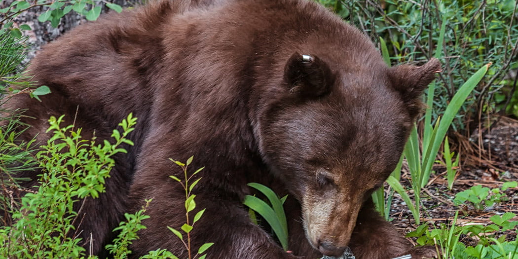
There are black bears on the Lost Coast!
On my last trip, I saw bear tracks on the beach in five separate locations. This post has some great info on dealing with black bears in the wilderness.
The BLM mandates that all backpackers have a hard bear-resistant container to store all food and scented items. Don't think you can get away with avoiding this - in addition to getting fined by a passing ranger, you will have a large, furry, hungry creature with giant claws tearing your tent open while you sleep.
Bear canisters are available for rent at some of the ranger locations, or you can purchase something like the BearVault if you're going to be making more trips into bear country.
Water
There are plenty of freshwater stream crossings throughout the entire route - just make sure you have a purifier. My lightweight backpacking purification options work well on this trail.


Weather & Tides on the Lost Coast Trail
Fall & winter backpackers will see nighttime temperatures in the 40s and daytime temperatures in the 60s-70s, with a lot of rain.
Spring & summer backpackers will see warmer temperatures and mostly dry conditions.
Showers can develop at any time though, so it's a good idea to bring a light poncho, a rain cover for your backpack, and a rainfly for your tent, even in the summer. Heavy winter & early spring rains can make some of the numerous stream crossings extremely difficult.
Some sections of the trail can be inaccessible at high tide. Maps (linked below) do indicate these sections.
It is imperative to know the tides. You do not want to be starting an inaccessible section as the tide is rising - you will get swept out to sea, and it's happened before with loss of life.
Link to Tideschart for Shelter Cove - including weather forecasts

Lost Coast Trail Permits (2017 Update)
Quotas are new for 2017.
Crowd sizes have been increasing every year, and Memorial Day weekend in 2016 set a record with hundreds of people on the coast at once. This is a problem!
There just simply isn't enough room on the Lost Coast to support this many people as camping spots are limited. Wilderness areas are impacted when backpackers are forced into areas that they normally wouldn't go. The Lost Coast Trail is constantly eroding.
You can get a permit at Recreation.gov. Gone are the days of getting a walk-in permit at the trailhead, but you may be able to try the ranger station.
Quotas for trailhead entry are as follows:
- 60 people per day during the high season from May 15 - September 15.
- 30 people per day from September 16 - May 14.
I know, quotas suck because you might not be able to get in when you want. But trust me, you don't want to share this serene, narrow trail with 200 other people.
If you're in the area and can't get a permit, check out the redwoods instead.
Miscellaneous Lost Coast Trail backpacking tips
- My base pack was almost 30 pounds, which was completely unnecessary. I'm now down to a 15-pound base pack with these techniques.
- If you plan on camping on the beach, bring sand stakes and/or cord for your tent. Regular stakes will not hold in the sand, especially during any kind of wind. Rock anchors may be a better option if you're expecting high winds.
No special permits are required for individuals. You can fill out a free permit at the self-serve kiosk at the Mattole Beach campground (this campground has a $8/night fee).See the previous section for new permit requirements.- Beginners may not want to backpack the Lost Coast, but if you're in great shape, go for it. Most of the trail is either soft sand, hard pebbles, and small boulders, so it's not like the packed trail that most people are used to. It will slow you down. There are numerous campsites along the trail though, so don't worry about rushing it.
- There's a lot of outstanding nature along this trail - whale watching, seals, sea lions, Roosevelt Elk, deer, black bear, river otters, birds of prey, and amazing wildflowers, especially in the spring. Bring some binoculars or a telephoto camera lens if you can afford the weight (I always trim my pack to make room!).
- Speaking of nature - there's also rattlesnakes, ticks, and skunks on the trail, all of which I experienced on the last trip. Be careful and practice appropriate precautions for all.
- There are a number of buildings along certain sections of the trail. All of them are private seasonal cabins, except for the Punta Gorda lighthouse, which can be explored. Please respect the private buildings.
- There are no latrines - bring a trowel. Dig your cat hole below the high tide line if possible, otherwise at least 200 feet from the nearest campsite and water source, 6"x6"x6". You must pack out your used TP so please plan ahead for this!
- A small, old cabin is available on a first-come, first-serve basis at Needle Rock. It can sleep about four people; check in with the Needle Rock visitor's center when you get there to check on availability. 6/2/2019: The road to Needle Rock is closed due to a slide about 2 miles from Needle Rock.



Lost Coast Trail Maps
Bureau of Land Management overview (no detail, PDF)
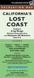
You can purchase a waterproof, detailed map from Wilderness Press. I've used this map three times and am quite honestly not too impressed with it. It has some great information and trail overview, but it's lacking any real topography and detailed mileage.
The ranger office has a great waterproof map published by the BLM; you can pick one up at the ranger station on the road to Shelter Cove.
BLM King Range National Conservation Area page
Watch the video
Visit the gallery (Click the photo)

Add your own Lost Coast Trail backpacking experiences or ask any questions below - I'll get back to you as soon as possible!
Great Post! We're hiking here later this month and I was wondering if you would share your trip itinerary with me or a recommended one? How many days/nights, where you camped etc. Also Ive read that we will be crossing a good amount of streams so Im wondering if you recommend taking sandals for these? Would you recommend taking gators for trekking in the sandy sections? Trekking poles? Thank you
Hi Brian, thanks.
My only recommendation for an itinerary is take your time and don't get caught in an impassible section at high tide! I spent the first night at the Mattole Beach campground (start of the trail) because we arrived late in the afternoon. Some people get there early and start hiking right away. We started just after sunrise.
We spent the second night at Spanish Creek on the south end of Spanish Flat. The third night was at Buck Creek. It has a few clear spots for tents on a short bluff, but if there's no room there are a few other camping spots nearby.
I don't think gators are necessary; the sand didn't find its way into my boots and it'd just add to the weight. I did bring some closed-toed sandals for stream crossings but I never used them. Mostly because I was lazy - I just took of my boots and socks and crossed the streams barefoot, but it was a little painful on the bottoms of the feet. I think I would have slipped out of regular sandals if I wore them, but they would have been nice to have in camp.
Trekking poles - they sure made the stream crossings MUCH easier, and also the sections where you're going over small boulders. Some of the stream crossings require balancing on log bridges and small rocks, and I'm a klutz so I'm glad I had them. Otherwise my pack and I would have ended up in the water multiple times. We've had a fairly dry winter but those streams can get moving pretty fast still.
CC'ing this to your email too.
https://plus.google.com/communities/114693060516611782975
"Lost Coast Trail" ....a new google plus community.
The link above is for a new community I recently created that I think you would be interested in joining. After joining, you can share you articles and videos on there with links to your website. I would really appreciate your joining and posting your information. I found you through your youtube video on the Lost Coast Trail. Its very well made and I look forward to hearing more from you.
Thanks for the link! I'll definitely join and contribute what I can...especially if I do it once a year as I hope to.
Wonderful post! Thank you for sharing the tips and stories!
I was about to start planning the backpacking hike to Lost Coast, and your information gave me nice insight.
I'd like to share this to my audience as well, is that OK?
Thanks, I'm glad you found it useful! Share with whoever you'd like. I make a trip out there every year and am constantly updating this.
Hi! THis is a very helpful post! Thank you!
I'm gonna go on a 3day/2night backpakcing trip at the end of July at the northern section of the Loast Coast Trail. Should I bring rain gear with me?
Hi! This is a very helpful post! Thank you!
I'm gonna go on a 3day/2night backpakcing trip at the end of July at the northern section of the Loast Coast Trail. Should I bring rain gear with me?
Glad you found it helpful! Yeah some light rain gear is always a good idea even if the forecast calls for sunny skies...rain can easily develop along the coast there.
Thank you for providing all of this information! Just one note: BLM does not allow the burial of toilet paper along with our waste. It states on their King Range Conservation Area website that it should be packed out. I confirmed this with a BLM ranger on the phone just to cover all bases. I'm so happy to see multiple resources for the hike online, but I want to make sure that the information presented (and likely to be repeated) is accurate. Please consider updating the page to reflect this. Thank you again for all of the instruction!
Thanks for the input Tiffany, this has been updated. Happy hiking!
Awesome 🙂 keep up the good work!
John,
Great information... thanks for taking the time to put it together.
I am planning a 3 day trip in a few weeks and am stuck deciding between the northern portion or southern. I am flying in from Missouri and only have a few nights for backpacking unfortunately.
If you had to pick between the two which would you pick based on sights and beauty. I understand they both have their own special difficulties terrain wise.
Would really appreciate any insight.
Thanks!
Hi Tammy, I'd definitely choose the northern section. The southern section is beautiful but the northern section really is one-of-a-kind. There's just something so unique and awesome about hiking and camping on this section of beach. Be prepared for some rain and wind. Have fun!
Thanks for the quick response! Okay the northern section it is then. I appreciate the help making up my mind.
Hi, Great blog! We are planning to hike the North part of the lost coast (We did the South last year) but since we don’t have permits we were planning to car camp and do day hikes. Can you suggest the most scenic part? Do you suggest us to start from Shelter Cove (we could hike North until Big Flat, go back to camp and go South until Needle Rock Visitor center the second day) or we could Start from Mattiole Beach going South and back. Thanks for the suggestion! We arrive Friday night and departure Monday afternoon and we would like to maximize the time by seeing the most scenic part. Thanks!
Thank you Greta! Yes, this is a very popular weekend, sorry you couldn't get a permit. It's all scenic, but there's definitely more variety in the scenery if you start from Mattole Beach. There's the lighthouse, seals, cabins, rivers, bluffs with views, and so on. It puts you closer to Spanish Flat, which will be full of wildflowers right now, but that's still going to be 18 miles roundtrip. The portion from Shelter Cove is more or less just beach. Hope this helps - have fun!
Thank you Jhon! This is very helpful!!Much appreciated the quick reply! 🙂
Thanks for the post, a lot of good tips. I will be (1st time) doing this on Tuesday...
Awesome, have fun! That’s one of my favorite trips. Stay warm!