Disclosure: This post may contain affiliate links. I earn a small commission of product sales to keep this website going.
John Muir Trail: Lyell Canyon to Red’s Meadow
To view all images from this segment, and/or to purchase prints, visit my John Muir Trail: Yosemite to Red’s Meadow photo gallery.
View the John Muir Trail Trip Report
Not every mile is represented in the photos for one reason or another. Direct journal entries in italics.
My camera had a catastrophic electrical failure the day before my permit started (which was two days before the rest of the group yet to arrive in Yosemite). I found cell service, overnighted a new camera to my parents from Amazon, and they delivered it to one of the hikers the night before everyone else left for Yosemite. Phew!
We started at Lyell Canyon and not Happy Isles. Lyell Canyon starts 25 miles into the John Muir Trail.
Next: Red’s Meadow to Muir Trail Ranch
Mile 26: Lyell Canyon & Lyell Fork of the Tuolumne
“Got my camera & it worked!”

The Lyell Fork of the Tuolumne River has an amazing emerald green color the entire way through Lyell Canyon, with the occasional deep swimming hole to cool off. Mile 26.
Mile 28: Lyell Canyon & Lyell Fork of the Tuolumne

The John Muir Trail/Pacific Crest Trail follows the Lyell Fork through most of Lyell Canyon. Mile 28.
Mile 29: Lyell Fork
“Continued south thru Lyell Canyon. Stopped at cascades just south of Ireland Creek for a break and soak the feet.”

At some points along the Lyell Fork, the river takes a break from its course through the meadow to cascade down granite slabs. Mile 29.
Mile 30: Ireland Creek Crossing

Many stream/river crossings on the John Muir Trail can be made with dry feet, if you find the right place to cross and don’t fall! Mile 30.
Mile 31: Lyell Canyon
“Past Ireland Creek another cool meadow with deer.”

Fallen trees in Lyell Canyon, looking south through the meadow. Mile 31.
Mile 32: Lyell Fork of the Tuolumne

The clear waters of the Lyell Fork of the Tuolumne River look extremely inviting for a dip! Mile 32.
Mile 33: Kuna Falls

Kuna Creek originates near Kuna Peak and flows three miles down the mountain ending in Kuna Falls in Lyell Canyon. Mile 33.
Mile 34: Lyell Canyon Views
“Then started climb up towards Donahue Pass. Great views of the meadow below, Mt. Lyell & Lyell Glacier. Tough switchbacks. Found big campsite along Maclure Creek near footbridge. Mosquitos from hell! Where is your head net?”

Don’t forget to look back! Hiking up Lyell Canyon yields views of the meadow you just hiked through a few miles ago. Mile 34.

Maclure Creek is a great camping spot to recharge before climbing Donahue Pass the following day. Mile 34.
Mile 35: Glacial Lake below Mount Lyell
“Left Maclure Creek for long uphill over Donahue Pass. Amazing little lakes and creeks the whole way up, under Mount Lyell.”

The clean, aqua, glacial waters below Mount Lyell. Mile 35.
Mile 36: Under & Over Donahue Pass

Mount Lyell is the highest peak in Yosemite National Park at 13,114′. Mile 36.
Mile 37: Descent to Rush Creek
“Went over Donahue and had great views of Cathedral Range, Mt. Ritter, and Banner Peak. Beautiful meadow and streams, very colorful, to Rush Creek.”

Red Mountain Heather in the meadow on the east side of Donahue Pass, headed towards Rush Creek. Mile 37.
Mile 38: Marching Towards Island Pass

Banner Peak and Mount Ritter become visible during the hike through the meadow approaching Island Pass. Mile 38.
Mile 39: Rush Creek Crossing

Mile 41: Island Pass
“Started up Island Pass, top was amazing with clear lakes and Banner Peak right behind them.”

Banner Peak as seen from Island Pass. Mile 41.
Mile 42: Thousand Island Lake

I didn’t count the islands, but there are a lot in Thousand Island Lake. Mile 42.
Mile 43: Emerald Lake
“Picked out camp at Emerald Lake. Mosquitos worse than I’ve ever experienced. At least 30 came in my tent with me. Climbed talus slope for views of Ritters and Thousand Island Lake. Came down and after dinner heavy smoke from that direction.”

Early morning reflections on Emerald Lake. Mile 43.
Mile 44: Ruby Lake
“Left Emerald Lake before everyone else to escape the bloodsuckers. Passed Ruby Lake as sun was hitting the wall behind the lake. Climb out not too bad – shallow switchbacks through thick forest.”

Reflections of the cliffs and snow surrounding Ruby Lake. Mile 44.
Mile 45: Garnet Lake
“Descended into Garnet Lake – great views with Banner behind it.”

Old logs sit in the shallow waters of Garnet Lake, on the east shore near the bridge crossing. Banner Peak and Mount Ritter in the background. Mile 45.
Mile 46: Descending Out of Garnet Lake

The rocky switchbacks leading south on the pass out of Garnet Lake. Mile 46.
Mile 48: Shadow Creek
“Descent into Shadow Creek. Took a break at cascades on Shadow Creek, continued to Shadow Lake – trees and walls right to waterline (shadow name?)”

Small cascades on Shadow Creek, which originates in the Ritter Range. Mile 48.
Mile 49: Shadow Lake

The trail pops out of the woods on the west side of Shadow Lake and then climbs up some never-ending switchbacks south towards Rosalie Lake. Mile 49.
Mile 50: Climbing out of Shadow Lake
“Climb out was strenuous – switchbacks never ended, but was shaded.”

The steep, endless switchbacks leading out of Shadow Lake. Mile 50.
Mile 51: Rosalie Lake
“Came down into Rosalie – great camp spot, many hikers there. At Gladys Lake decided to continue to make progress towards Reds, stopping at two ponds unsuitable for camping.”

One of the many small lakes that the John Muir Trail passes by. Rosalie Lake, Mile 51.
Mile 57: Minaret Creek
“Found spot at Johnston Meadow. Hardly any bugs here! Great private swim hole behind us at Minaret Creek. Can’t believe the trash on the trail – people come here to enjoy this place, and leave trash? Collected 1/2 bear canister of it (almost).”

Minaret Creek flowing below our campsite near Johnston Meadow. Mile 57.
Mile 58: The Devil’s Windstorm
“I’m the only one in the group with no blisters! Left Johnston Meadow for downhill into Devil’s Postpile – crazy trees toppled from November 2011 windstorm.”

Trees felled by “The Devil’s Windstorm” on November 30, 2011. Thousands of giant trees were uprooted when winds exceeding 125 miles per hour suddenly blew out of the northeast. Mile 58.
Mile 59: Devil’s Postpile National Monument

Devil’s Postpile National Monument – an interesting example of geologic wonders. Mile 59.
Mile 60: Red’s Meadow Resupply
“Went into Red’s Meadow for resupply, beer, and burgers. Burger okay, shat it out two hours later.”
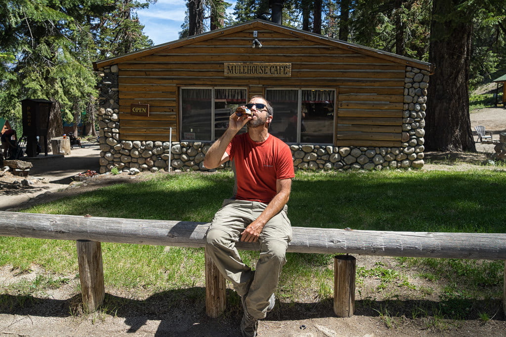
Red’s Meadow. Burgers, beer, resupply, and a general store. Mile 60.