Road Trip Day One: A Hidden Cavern at Natural Bridge
Disclosure: This post may contain affiliate links. I earn a small commission of product sales to keep this website going.
Since I ran out of time to get in the water and go sailing for a few months, I decided I needed to reward myself with a long road trip around northern California and Oregon. A reward for failing? Yeah, something like that. I didn't do any sightseeing on my last trip to the Caribbean - just work in the boatyard. I did need to do something fun after that.
I also needed to get the photography fingers moving again. I had taken very few photos over the past couple of months as I worked on other time-consuming projects. Had to brush the dust off and find some photography inspiration.
My route would take me counter-clockwise, going through Lassen Volcanic National Park first and ending southbound on the Pacific Coast Highway. But Lassen and Crater Lake were still snowbound. I wanted to be able to drive through those parks, so at the last minute (this whole trip was last-minute) I decided to go clockwise, saving Lassen and Crater Lake for last. That'd hopefully give them some extra time to get the roads clear. We'll see if that worked!
I've always loved California Highway 49. Every time I'm on it I think to myself, I need to do this drive more often. It's only an hour away from me. I can easily jump over there for a morning or afternoon and explore the hills of California Gold Country (hence the designator Highway 49).
There are a number of caves and caverns in the area of Columbia, a preserved mining town near Sonora. A lot of these caves have commercial enterprises like guided tours and ziplining. Fun, sure, but that's not my style. Natural Bridge is more secluded, so that was my detour stop on my way to Pinnacles National Park.
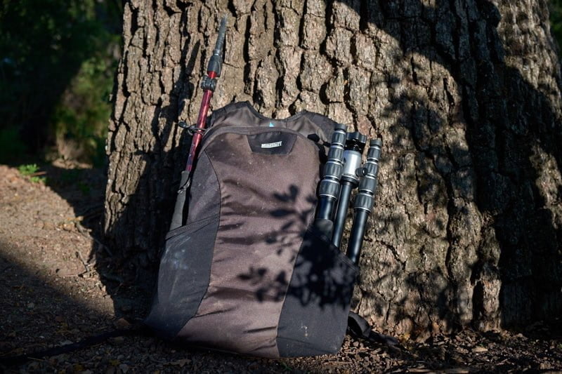
Photography gear selection
I would normally just take my Think Tank Speed Demon hip bag on a short hike like this. But since I'd be exploring a cave I needed a tripod also, and I haven't yet found a good way to secure a tripod to the Speed Demon. So I used my MindShift SidePath bag, stowing my new tripod (also testing out the MeFoto RoadTrip tripod on this trip) on one side and a compact hiking pole on the other side, just in case I needed it for stability in the water.
For this hike I packed my Fujifilm X-T1 with 18-55mm f/2.8, along with a 14mm f/2.8 and 55-200mm f/3.5. Both of those last two lenses are rentals from BorrowLenses.com; I'm still in the process of figuring out which lenses I want for my lightweight travel photography kit now that I switched from Sony to Fujifilm. I figured I'd rent some to see how I like them versus my usual process of buying new lenses, deciding I'm not into them after the return period expires, and then trying to sell them on eBay. I did fall in love with the Fujifilm 50-140mm f/2.8, but it's a beast of a lens. Meaning the quality is amazing but you pay for it with size, weight, and price.
I handheld my X-T1 for the entire hike using Peak Design's hand clutch - a new thing for me. If you recall, I've been using Peak Design's Slide Strap with Capture Clip to secure my camera in a manner where it's always available while hiking. Still a good solution, but I wanted to see how comfortable the hand strap was.
The Natural Bridge Hike
The hike is fairly easy and just over two miles round-trip. Total elevation gain is a touch past 300 feet, and like most out-and-back hikes to water, the climb is at the very end. It starts with a gentle downhill following a creek and in the shade of oaks. After about a half-mile I left the shade and arrived at a vista looking down the valley. The trail continued along the hillside and down to the creek. Large hawks were floating over the gulch, and the trail was lined with poppies.


Eventually I got to a point where, looking down on the creek, there's a very obvious shadow created by a cave. This feature is more of a bridge; the opening is just tall enough to stand up in and is quite wide. I could just make out light coming from the other end. Small birds flew in and out of this cavern, and drops of water fell on my head no matter where I went underneath this bridge. I stuck around for a few photos. I wanted to walk to the other end inside the cave but the water looked like it got quite deep in spots. So I walked back up the hill to a trail fork that took me down to the other end of the cave.


Accessing the other end of the cave was a little more difficult. It's very steep and slick rock down to the river from the trail. There are just enough well-spaced tiny footholds, but the rock was still slick and didn't provide much for handholds. Hey, look, a yellow polypropylene rope! Some kind soul had anchored a rope to assist the descent and climb out. It seemed sturdy so I followed it down to the water. The opening on this side is more oval in shape, perhaps twenty feet tall. The mouth is lined with lush green vegetation, and where the sunlight ends, smooth limestone begins. As with the other end, I thought about walking in to see how far I could get, but the water immediately looked like it was almost hip deep.


I never did use the telephoto zoom on this hike. I guess if I were more of a birder I would have used it. I also didn't bring the drone; there might have been a couple opportunities for aerials but nothing jaw-dropping. This also wasn't a good idea with all of the hawks I saw in the area - both for my sake and for theirs.
Following the hike...
After getting back to the car it was onward to Pinnacles National Park. From CA49 I took CA4 west. This is another great springtime drive, almost a straight shot through bright green, rolling farmland. I told my navigation app to avoid major highways, so I only had to get on CA99 and I-5 for a few minutes. The rest of it was through some scenic backcountry farm roads.
I arrived at Pinnacles National Park in late afternoon and drove through the campground, hoping I'd find an open spot. They all had "reserved" signs, but upon closer inspection, I noticed that they were mostly for the following night. I snagged a site, made dinner, and just relaxed the rest of the night!
I'll tell ya though, between the frogs and the wild turkeys and the kids' group camp across the creek...it was a loud night. With a long hike planned for the next day!
I especially like your interior cave shots; the second from the last had me pausing and returning. Nice. I've long meant to visit this spot. Were you as alone as it looked?
I was alone! There was one couple leaving as I approached the other side of the cave, then two couples coming up the trail as I returned to the car. Maybe next time I'll have the balls (or dim wits) to try walking through the whole thing.